Category:Darłowo lighthouse
Jump to navigation
Jump to search
| Object location | | View all coordinates using: OpenStreetMap |
|---|
lighthouse in West Pomeranian Voivodeship, Poland  Maják Darlowo | |||||
| Upload media | |||||
| Instance of | |||||
|---|---|---|---|---|---|
| Location | Darłowo, Sławno County, West Pomeranian Voivodeship, Poland | ||||
| Located in or next to body of water | |||||
| Heritage designation | |||||
| Service entry |
| ||||
| Inception |
| ||||
| Height |
| ||||
 | |||||
Polski: Darłowo - latarnia morska (z budynkiem pilotów), 1885.
English: Darłowo Lighthouse
Media in category "Darłowo lighthouse"
The following 33 files are in this category, out of 33 total.
-
 Border Protection Forces in Darłowo, 1949 01.jpg 3,492 × 2,223; 2.56 MB
-
 Border Protection Forces in Darłowo, 1949 02.jpg 2,230 × 3,487; 3.74 MB
-
 Border Protection Forces in Darłowo, 1949 03.jpg 2,177 × 3,504; 3.6 MB
-
 Darlowko latarnia 01.jpg 1,536 × 2,048; 636 KB
-
 Darlowko latarnia 02.jpg 2,048 × 1,536; 587 KB
-
 Darlowko latarnia 03.jpg 1,536 × 2,048; 612 KB
-
 Darlowko-latrnia-IMG 0104.jpg 3,504 × 2,336; 746 KB
-
 Darlowo latarnia morska 1.jpg 484 × 800; 69 KB
-
 Darlowo poland stimoroll.jpg 4,024 × 2,968; 9.01 MB
-
 Darlowo.gif 25 × 40; 494 bytes
-
 Darłowo - fotopolska.eu (20017).jpg 1,024 × 695; 134 KB
-
 Darłowo - latarnia morska.jpg 2,565 × 1,683; 2.68 MB
-
 Darłowo lighthouse kz01.jpg 3,039 × 4,254; 2.26 MB
-
 DARŁÓWKO, AB-022.jpg 960 × 720; 52 KB
-
Działający aparat optyczny latarni morskiej Darłowo.ogv 1 min 10 s, 640 × 480; 7.73 MB
-
 Latarnia Darłowo.jpg 700 × 465; 85 KB
-
 Latarnia Morska - wysokość 21 metrów - panoramio.jpg 1,920 × 2,560; 967 KB
-
 Latarnia morska Darłowo o zachodzie słońca.jpg 1,315 × 1,052; 3.73 MB
-
 Latarnia morska Darłowo od strony zachodniej.jpg 5,000 × 3,333; 8 MB
-
 Latarnia morska Darłowo widziana od strony wejścia do portu.jpg 3,333 × 5,000; 6.22 MB
-
 Latarnia morska Darłowo widziana z zachodniej strony kanału.jpg 5,000 × 3,333; 5.88 MB
-
Latarnia morska Darłowo.mp3 11 min 35 s; 10.62 MB
-
 Latarnia Morska w Darłówku Wsch..jpg 346 × 350; 85 KB
-
 Latarnia Morska w Darłówku.jpg 3,456 × 5,184; 2.52 MB
-
 Latarnia morska, Darłowo.jpg 1,536 × 2,048; 349 KB
-
 Latarnia w Darłowie.jpg 4,200 × 2,630; 5.62 MB
-
 Lighthouse in Darlowo 01.JPG 2,048 × 1,536; 690 KB
-
 Lighthouse in Darłówko 2.jpg 3,456 × 4,608; 3.3 MB
-
 Lighthouse in Darłówko.jpg 3,456 × 4,608; 3.12 MB
-
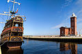 Statek wycieczkowy, stylizowany na historyczny.jpg 615 × 350; 148 KB
-
 Widok z latarni morskiej Darłowo w kierunku miasta i portu.jpg 5,000 × 3,333; 9.15 MB
-
 Darłówko, wejście do portu.jpg 3,264 × 2,448; 1.32 MB
-
 Światło latarni morskiej w Darłowie.jpg 5,000 × 3,333; 6.55 MB


.jpg)


